Planned Capture
Flight direction based on the project, site and final output.
From marketing content and project documentation to mapping, panoramas and architectural visuals, Halo Hover delivers structured aerial outputs for commercial, construction and real estate environments.
Every flight is planned around the final use: marketing, documentation, mapping, stakeholder updates or property presentation. Halo Hover combines aerial capture, visual direction and structured delivery to make each output useful beyond the shoot day.
Flight direction based on the project, site and final output.
Visuals prepared for records, sharing, presentations or campaigns.
Operations planned around site access, safety and approval requirements.
For events, hospitality, real estate, campaigns and commercial spaces, Halo Hover creates aerial content that gives brands and properties a stronger visual presence across websites, social media, presentations and launch campaigns.
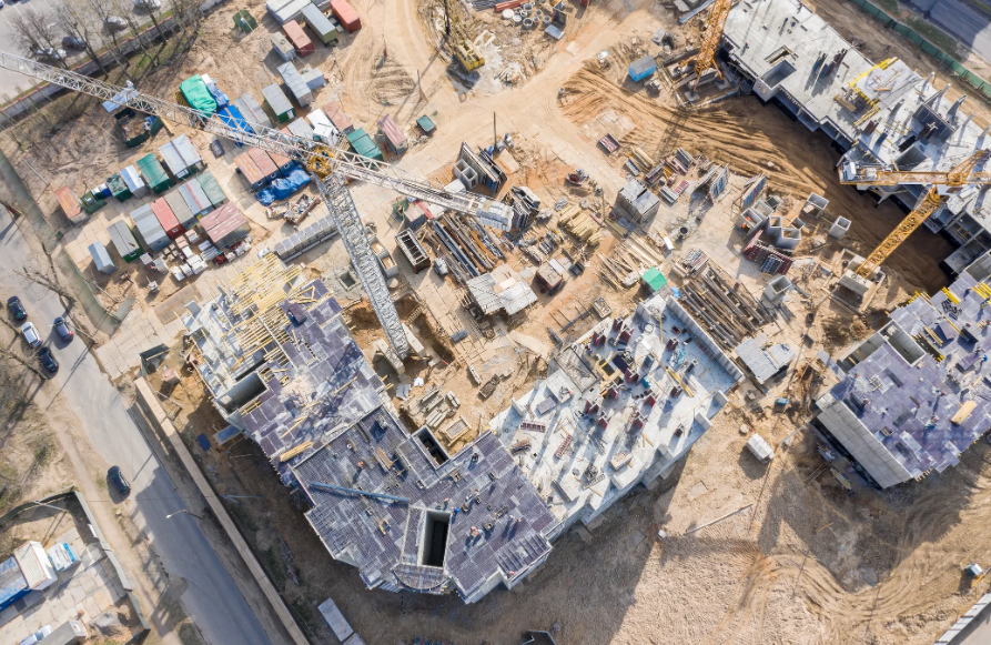
Halo Hover helps project teams track site progress through structured aerial visuals that support reporting, communication, milestone visibility and stakeholder updates.

Scheduled aerial records help project teams track visible site development, construction activity and completed work across reporting periods.
Consistent aerial views provide site context for internal reviews, consultant updates, contractor coordination and stakeholder communication.
Capture key project stages, access conditions, material movement and site readiness with organized visual records.

Halo Hover creates aerial mapping and spatial outputs that help teams understand site layout, location context, access, boundaries and visual relationships through top-down views, 3D site references and aerial panoramic context.
Top-down site visuals prepared for layout understanding, location review, site reference and presentation use.
Aerial-based spatial views that help communicate site form, massing, terrain context and surrounding relationships.
Elevated panoramic views that show surroundings, boundaries, access routes and location context more clearly.
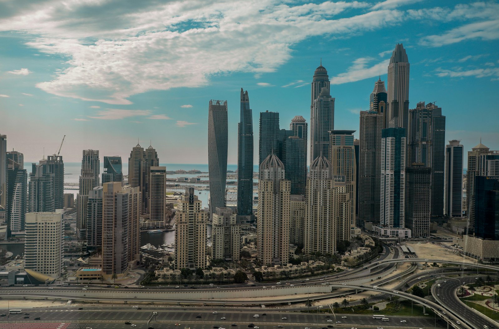
Halo Hover captures architectural forms, exterior spaces and property environments through clean aerial visuals prepared for portfolios, marketing, presentations and client communication.
 Exterior View
 Project Showcase
 Presentation Asset
Clean aerial stills for completed projects, developments, exterior spaces and property portfolios.
Smooth aerial video sequences for project showcases, brand films, websites and presentation decks.
Aerial references and visual assets that support renders, proposals, design presentations and project storytelling.